| Thema: | Digitale Erstellung eines Luftbild-Kartenwerkes für das Nds. Forstamt Sellhorn und den Stadtforst Wolfsburg | |
| Ansprechpartner: | GISCON Ingenieurbüro | |
| Kurzbeschreibung: | Digitale Erstellung eines Luftbild-Kartenwerkes für das Niedersächsische Forstamt Sellhorn und den Stadtforst Wolfsburg | |
| Auftraggeber: | Niedersächsisches Forstplanungsamt Wolfenbüttel |
|
| Umsetzungszeitraum: | 2006 | |
| Details / Beschreibung: | 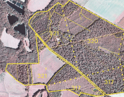 Die im Bereich des Niedersächsischen Forstamtes Sellhorn ("Lüneburger Heide") sowie der Stadtforsten Wolfsburg vorliegenden Color-Infrarot-Luftbilder wurden in Orthophotos überführt. Eine anschließende Überlagerung mit den Vektor-basierten Informationen der forstlichen Waldeinteilung und drucktechnische Ausgabe führten zu einem Luftbild-Kartenwerk, welches für weitere forstliche Anwendungsbereiche zur Verfügung steht. |
|