Global Net FX - Query Module
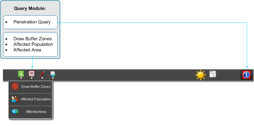
The Query Toolset provides tools to query data with predefined functions. Check the Query Toolset to enlarge the hidden tools.
- One of the basic functions to get information about desired features or layers is the so called Penetration Query, hiding an identifier
- Draw Buffer Zones enables to draw buffer graphics around features
- Affected Populatation informs how many citizens are within a desired area
- Affected Area informs about shared area of input polygons with other layer
Penetration Query
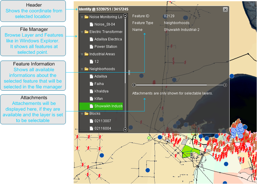
The Penetration Query Tool is a standard identifier for features. All results will be structured in a treeview like in Windows Explorer. Identifiable are all visible features on map.
Click the toggle button in the user interface to activate Penetration Query. Than click on the feature you are interested. The Penetration Query remains active till deactivation through another click on the toggle button.
The identifier window includes on left hand the navigation with the layer and associated features and on the right hand the information about the selected object. A special feature within the Penetration Query represents the attachments. If available it will be displayed within this window. Attachments could be a photo, video or document and will be shown as a thumbnails list according to the ESRI samples.
Draw Buffer Zones
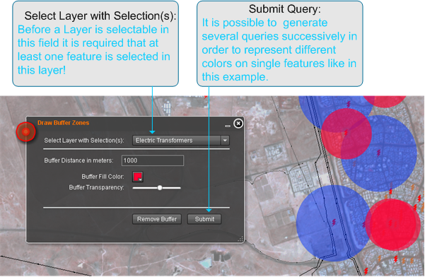
Within this tool, the user is able to draw a variety of radial buffers graphics around the same or different features. Doing this, the different buffers can overlay another but can be made visible through different settings. For each buffer the buffer distance, colour and transparency can be selected. The transparency allows the visibility for the underlying layers, features or buffers.
The resulting buffer remains till the user clicks the Remove-Buffer-Button.
Affected Population
The Affected Population Tool is able to calculate the sum of involved citizens from a defined area at any event.
To start with, select one feature of a polygon layer or trace the desired area. The result is the number of affected people that will be display afterwards inside the defined areas. These number varies by choosing on of the predefined population layers. By choosing Remove Result the drawn polygon and of course the results will be removed from mapdisplay.
The following settings will show an usecase with the associated result.


