GISCON is proud to be the consultant of the Environment Public Authority (EPA) of Kuwait in all geospatial relevant matters and technologies. GISCON provides consultation and technical advice to the EPA already since March 2008. Among other things, GISCON prepared the plans and design of the Environmental Monitoring Information System of Kuwait (eMISK) and Kuwait Official Environmental Portal (www.beatona.net). GISCON continues to provide the EPA with consultation services during the implementation of eMISK including the overall quality control, validation and acceptance of the products through out the project. GISCON provides the EPA with three resident consultants and 12 other on-call consultants specialized in different disciplines such as field surveying with GPS, remote sensing, cartography, ArcGIS Server and environmental subject matter experts.
Three main outputs are delivered within the eMISK project
| 1. | eMISK GeoDatabase The infrastructure for the eMISK geodatabase has been put in place, along with all hardware and software components. Assessment of user needs and data modelling were implemented by a team of experts to come up with the requirement analysis and recommendation for the design of eMISK geodatabase and systems, which will form the backbone of Kuwait EPA data repository. Eleven data domains are identified to organise data within eMISK geodatabase; each domain represents an environmental sector. >more
|
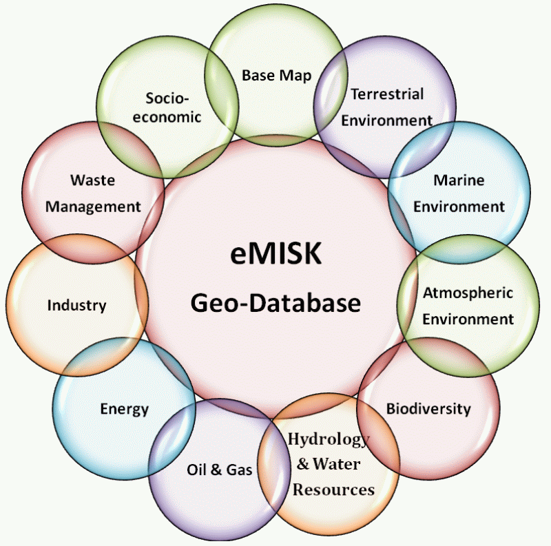 eMISK GeoDatabase domains eMISK GeoDatabase domains |
||||
| 2. | eMISK Enterprise GIS | |||
|
To enhance Kuwait EPA capabilities in the monitoring and communication, awareness generation and dissemination of environmental knowledge related to environmentally sensitive issues and activities in Kuwait, Kuwait EPA established a customized EPA-wide GIS-based information system called the “Environmental Monitoring Information System of Kuwait (eMISK)”. eMISK combines Geographic Information Systems (GIS) and other relevant technologies such as remote sensing, GPS and web-GIS based services with the state-of-art hardware and software, based on the latest Technology and highly secured networking infrastructure. >more |
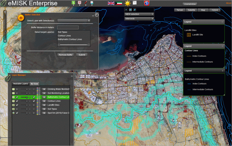 Spatial Analysis with eMISK Enterprise Spatial Analysis with eMISK Enterprise |
|||
|
|
||||
| 3. | Kuwait Official Environmental Portal (Beatona.net) | ||||||||
| The search for environmental information in Kuwait has been a challenge for the citizens and residents of Kuwait for a long time. They have usually ended up with a set of outdated and contradictory information emerging from various organizations and institutions working on the environment in Kuwait. Accordingly, Kuwait Environment Public Authority (EPA) has taken the initiative to establish Kuwait Official Environmental Portal "Beatona.net" in order to share authentic environmental information about Kuwait with the public over the internet in an easy and transparent manner. Beatona (our environment) is the Arabic name chosen for this portal, which is a key component and output of the Environmental Monitoring Information System of Kuwait (eMISK). >more | 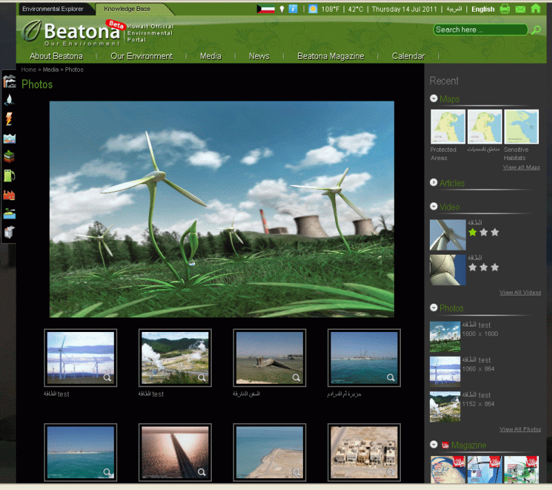 Beatona.net: Knowledge Base Beatona.net: Knowledge Base |
||||||||