


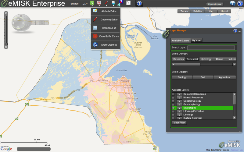
 The main user interface of eMISK Enterprise The main user interface of eMISK Enterprise |
Kuwait’s Environment Public Authority (Kuwait EPA), provides leadership in the nation's environmental science, research, monitoring, education and assessment efforts. It works closely with other federal agencies and local government organizations to develop and enforce regulations under existing environmental laws. Kuwait EPA is responsible for setting national standards for a variety of environmental programs, monitoring and enforcing compliance. | |
Where national standards are not met, Kuwait EPA can issue sanctions and take other steps to assist the state in reaching the desired levels of environmental quality. The Authority also works with industries and with all levels of government bodies in a wide variety of pollution prevention programs and energy conservation efforts. |
||
To enhance Kuwait EPA capabilities in the monitoring and communication, awareness generation and dissemination of environmental knowledge related to environmentally sensitive issues and activities in Kuwait, Kuwait EPA established a customized EPA-wide GIS-based information system called the “Environmental Monitoring Information System of Kuwait (eMISK)”. eMISK combines Geographic Information Systems (GIS) and other relevant technologies such as remote sensing, GPS and web-GIS based services with the state-of-art hardware and software, based on the latest Technology and highly secured networking infrastructure.
As a major component of the eMISK system, and to realize its objective, Kuwait EPA has developed an intranet-based GIS application, eMISK Enterprise, to be used by the staff from various departments of EPA to view, update, query, analyze and report environmental monitoring data. This system provides generic GIS functions to be used by the EPA staff. These functionalities are generic in nature, which means the same functionalities are available to all authorized users of EPA, regardless of the department or division.
In addition to being a simple viewer, eMISK Enterprise provides a range of analysis and editing tools to assist the EPA staff members in their routine activities. It is developed on configurable and extensible application architecture using ArcGIS server and Flex API’s, supports a bilingual user interface to facilitate smooth working in both Arabic and English languages. It is also equipped with a powerful ‘user management system’, which enables defining specific rights and permissions. It also maintains complete log of activities to assist in tracking the changes made in the data and information by every single user.
For providing GIS consultancy for the eMISK system, Kuwait EPA engaged GISCON Solutions, a specialized consulting company based in Kamen, Germany, offering GIS consulting services, custom solutions and training. The main focus of GISCON Solutions is to help the Kuwait EPA to plan and design the eMISK program, to monitor and ensure the quality of the system implementation, to solve any technical problems and to assist the EPA during the evaluation and acceptance of the eMISK outputs.
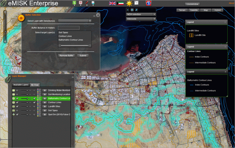 Spatial Analysis with eMISK Enterprise Spatial Analysis with eMISK Enterprise |
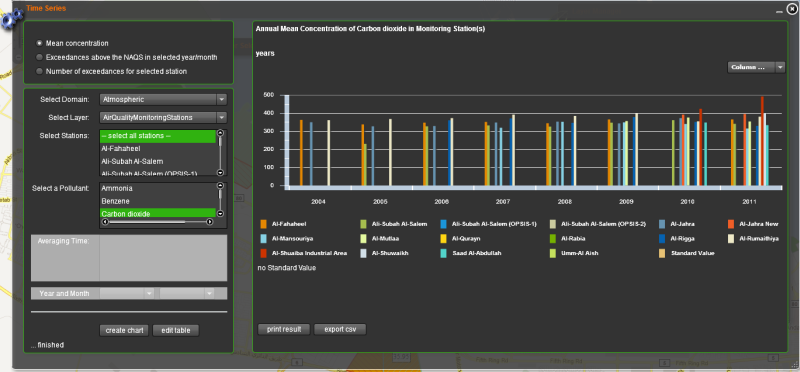 Time Series data representation and analysis with eMISK Enterprise Time Series data representation and analysis with eMISK Enterprise |
|
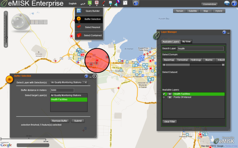 eMISK Enterprise buffer analysis example: Finding health facilities that fall within a buffer distance of an air quality monitoring station. eMISK Enterprise buffer analysis example: Finding health facilities that fall within a buffer distance of an air quality monitoring station. |
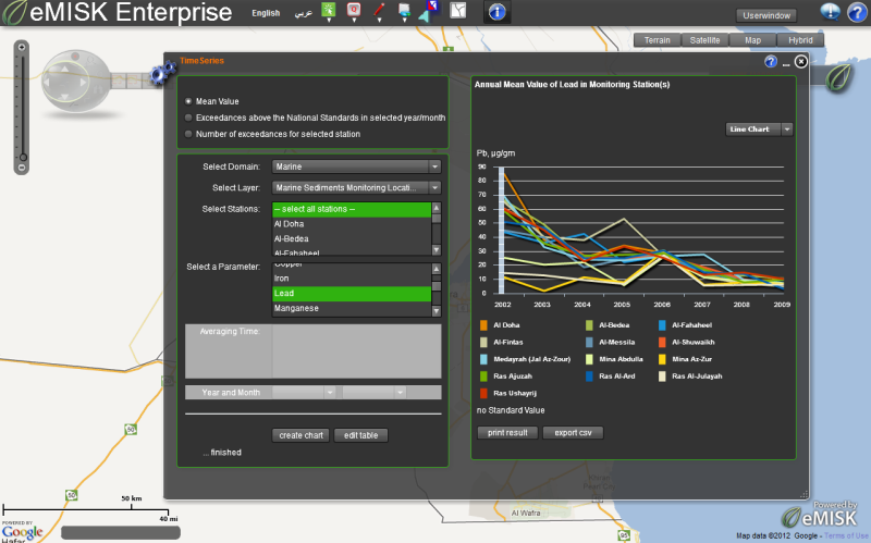 eMISK Enterprise time series analysis example: Calculating the annual mean value of lead in marine sediments. eMISK Enterprise time series analysis example: Calculating the annual mean value of lead in marine sediments. |