ALK/ATKIS-Reader, ARCEDBS, ARCSICAD, AWANI, GDFARC, GEODAVE, GEOSUM, the GEOSUM-Logo, GISCON, GISCON HYRONET, the GISCON-Logo, HYDROTOOLS, MEDIS, SICAD-Reader and www.giscon.de are trademarks, registered trademarks, or service marks of GISCON.
The ESRI-Germany Logo is registered trademark of ESRI Deutschland GmbH.
3D Analyst, ACORN, ADF, AML, ArcAtlas, ArcCAD, ArcCatalog, ArcCOGO, ArcData, ArcDoc, ArcEdit, ArcEditor, ArcEurope, ArcExplorer, ArcExpress, ArcFM, ArcGIS, ArcGlobe, ArcGrid, ArcIMS, ARC/INFO, ArcInfo, ArcInfo Librarian, ArcInfo-Professional GIS, ArcInfo-The World's GIS, ArcLocation, ArcLogistics, ArcMap, ArcNetwork, ArcNews, ArcObjects, ArcOpen, ArcPad, ArcPlot, ArcPress, ArcQuest, ArcReader, ArcScan, ArcScene, ArcSchool, ArcSDE, ArcSdl, ArcStorm, ArcSurvey, ArcTIN, ArcToolbox, ArcTools, ArcUSA, ArcUser, ArcView, ArcVoyager, ArcWatch, ArcWeb, ArcWorld, ArcXML, Atlas GIS, AtlasWare, Avenue, Business Analyst Online, BusinessMAP, Community, CommunityInfo, Data Automation Kit, Database Integrator, DBI Kit, EDN, ESRI, ESRI-Team GIS, ESRI-The GIS Company, ESRI-The GIS People, FormEdit, Geographic Design System, ESRI BIS, Geography Matters, Geography Network, GIS by ESRI, GIS Day, GIS for Everyone, GISData Server, InsiteMAP, JTX, MapBeans, MapCafé, MapData, MapObjects, Maplex, ModelBuilder, MOLE, NetEngine, PC ARC/INFO, PC ARCPLOT, PC ARCSHELL, PC DATA CONVERSION, PC STARTER KIT, PC TABLES, PC ARCEDIT, PC NETWORK, PC OVERLAY, PLTS, Rent-a-Tech, RouteMAP, SDE, Site·Reporter, SML, Sourcebook·America, Spatial Database Engine, StreetEditor, StreetMap, TABLES, Tapestry, the ARC/INFO logo, the ArcAtlas logo, the ArcCAD logo, the ArcCAD WorkBench logo, the ArcCOGO logo, the ArcData logo, the ArcData Online logo, the ArcEdit logo, the ArcEurope logo, the ArcExplorer logo, the ArcExpress logo, the ArcFM logo, the ArcFM Viewer logo, the ArcGIS logo, the ArcGrid logo, the ArcIMS logo, the ArcInfo logo, the ArcLogistics Route logo, the ArcNetwork logo, the ArcPad logo, the ArcPlot logo, the ArcPress for ArcView logo, the ArcPress logo, the ArcScan logo, the ArcScene logo, the ArcSDE CAD Client logo, the ArcSDE logo, the ArcStorm logo, the ArcTIN logo, the ArcTools logo, the ArcUSA logo, the ArcView 3D Analyst logo, the ArcView Business Analyst logo, the ArcView Data Publisher logo, the ArcView GIS logo, the ArcView Image Analysis logo, the ArcView Internet Map Server logo, the ArcView logo, the ArcView Network Analyst logo, the ArcView Spatial Analyst logo, the ArcView StreetMap 2000 logo, the ArcView StreetMap logo, the ArcView Tracking Analyst logo, the ArcWorld logo, the Atlas GIS logo, the Avenue logo, the BusinessMAP logo, the Community logo, the Data Automation Kit logo, the Digital Chart of the World logo, the ESRI Data logo, the ESRI globe logo, the ESRI Press logo, the Geography Network logo, the MapCafé logo, the MapObjects Internet Map Server logo, the MapObjects logo, the MOLE logo, the NetEngine logo, the PC ARC/INFO logo, the Production Line Tool Set logo, the RouteMAP IMS logo, the RouteMAP logo, the SDE logo, The World's Leading Desktop GIS, Water Writes, www.esri.com, www.esribis.com, www.geographynetwork.com, www.gis.com and www.gisday.com are trademarks, registered trademarks or service marks of Environmental Systems Research Institute, Inc. (ESRI).
Other companies and products mentioned in the GISCON Website may be trademarks or registered trademarks of their respective trademark owners.

خدمات نظم المعلومات الجغرافية
غطي نطاق الخدمات والأنشطة جميع المراحل التنفيذية لنظم المعلومات الجغرافية من تصميم وتطوير وادار
البنية التحتية للبيانات المكانية (SDI)
يجب اتاحة جميع البيانات المكانية بسرعة وكفاءة مهما كان شكلها أو مصدرها
الاستشارات وإدارة المشاريع
توفير الخدمات الاستشارية ووضع وتنفيذ نظم متكاملة لادارة مشاريع نظم المعلومات الجغرافية
نحن نوجد حلول فعالة من خلال بناء علاقات مستدامة مع عملائنا
أخبار

EPAP - Egyptian Pollution Abatement Program - Meeting with the Minister of Environment
We were honored at GISCON to meet H.E. Dr. Manal Awad, Minister of Local Development and Acting Minister of Environment, and present the Digital Environmental Registry for Industrial Establishments in Egypt, developed under the umbrella of the Egyptian Pollution Abatement Program - EPAP.
إطلاق نظام إدارة معلومات المخلفات (WIMS)
يفخر فريقنا في GISCON بالإعلان عن الإطلاق الرسمي لنظامنا الرائد لإدارة معلومات المخلفات (WIMS)

تعتزم جيسكون عقد دورة تدريبية بعنوان "إدارة مشاريع نظم المعلومات الجغرافية" في مارس 2023
تعتزم شركة جيسكون ميدل إيست لاستشارات تقنية المعلومات، بما لها من خبرة طويلة في تنفيذ مشاريع نظم المعلومات الجغرافية عالميا وإقليميا وبالذات في دولة الكويت، تنظيم دورة تدريبية بعنوان "إدارة مشاريع نظم المعلومات الجغرافية" وذلك في الفترة من 12 إلى 16 مارس 2023.
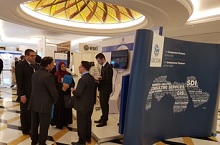
حضور كبير لشركة "جيسكون" في مؤتمر مستخدمي نظم المعلومات الجغرافية الكويتي العاشر لعام 2018
شاركت"جيسكون" الشرق الأوسط مع العديد من الشركات من قطاع نظم المعلومات الجغرافية في المؤتمر العاشر لمستخدمي نظم المعلومات الجغرافية في الكويت لعام 2018 الذي عُقد في فندق ريجنسي في الكويت.

"جيسكون" تشارك في المؤتمر العاشر لمستخدمي نظم المعلومات الجغرافية في الكويت لعام 2018
"جيسكون" تشارك في المؤتمر العاشر لمستخدمي نظم المعلومات الجغرافية في الكويت لعام 2018

"جيسكون" تطلق موقعها الإلكتروني الجديد باللغة الإنجليزية
قامت "جيسكون" بإحياء تواجدها على الإنترنت من خلال موقع ويب جديد باللغة الإنجليزيةwww.giscon.eu

خدمات نظم المعلومات الجغرافية
اقرأ المزيد
التقنيات ومجالات التطبيقات
اقرأ المزيد
حلول البرمجيات
اقرأ المزيد
البنية التحتية للبيانات المكانية
اقرأ المزيدلماذا جيسكون؟
مستشارون مستقلون
يلتزم المستشارون والخبراء في جيسكون باستخدام المعايير العالمية مثل معايير البيانات المكانية المفتوحة (OGC)، والمنظمة الدولية للمعايير (ISO) والبنية التحتية للبيانات المكانية الأوربية (INSPIRE) وغيرها من المعايير ذات العلاقة.
خبرة عريضة في عدة مجالات
يضم فريق جيسكون عددا من الخبراء المتخصصين في مجال العمل (SMEs) بالإضافةً إلى خبراء نظم المعلومات الجغرافية (GIS) ، لذلك فإننا نتحدث نفس لغة مجال العمل ونتفهم تمامًا الاحتياجات والمتطلبات الخاصة به ونوفرها.
شبكة دولية من الشركاء والخبراء
تضم شبكة جيسكون الدولية مجموعة من الشركاء المتميزين من مختلف المؤسسات الحكومية والجامعات والمنظمات غير الحكومية، بالاضافة الى الخبراء المستقلين والقطاع الخاص. وتتكون فرق المشروع دائماً من أكثر الخبراء كفاءه في التعامل مع القضايا المطروحة، سواء كانوا من موظفي جيسكون أو من أحد شركائنا.
نماذج دعم مرنة ومتنوعة
تقدم جيسكون مستويات متنوعة من التفاعل مع عملائها للحصول على الدعم من خلال تقديم الخبرات والخدمات الاستشارية. ووفقاً لاحتياجات العملاء ومتطلباتهم والامكانات المالية المتاحة ، فإن جيسكون لديها القدرة و المرونة على مشاركة فريق العميل ودعمه والاندماج فيه.
الحلول الشاملة لتقنية المعلومات
توفر جيسكون حلول وخدمات تقنية المعلومات والاتصالات (ICT) بشكل متكامل حين ترتبط نظم المعلومات الجغرافية بأنظمة إدارة المستندات (DMS)، أوتخطيط الموارد المؤسسية(ERP) ، أونظم إدارة المحتوى(CRM) ، أوإنترنت الأشياء (IoT)، أوالبيانات الضخمة (Big Data) وغيرها من الأنظمة والتقنيات ذات الصلة.
استدامة البحث والتطوير والابتكار
تؤمن جيسكون بأن استدامة البحث والتطوير هو ما يمكننا من دعم عملائنا بحلول فعالة وموثوقة، ويجعلنا قادرين على المنافسة في سوق سريع التغير. ونقوم باختبار وتطبيق الأنظمة والحلول والابتكارات داخل بيئة العمل الخاصة بنا قبل أن ننفذها أو نوصي بها لعملائنا.